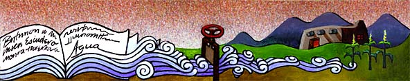
Land Grants in a
Nutshell
Lecture Notes. © 1997
Malcolm Ebright
I. Types of Land
Grants
1. Private Grants. Entire grant is owned by one
(or a few) individuals as their private property. After
meeting the conditions of the grant, the grantees could sell
the entire grant (note that regarding sales of smaller
parcels to be occupied by the purchaser, the custom of right
of first refusal was often followed).
2. Community Grants. Large tracts of land granted
to a substantial number of people (usually from 10 to 100.
Both Mora grant and early version of TA (Tierra Amarilla )
grant had 76 initial settlers - see Ebright Tierra Amarilla
Grant pp. 32-43 for examples of grant documents.
3. Hybrid or Quasi-Community grants. Large tracts
granted to one or a few individuals with the requirement
that the land be settled. Grantee induces a large group of
settlers to move onto the grant and gives them each a small
private lot for house (solar de casa) and garden (suerte)
and grants them rights to use the remaining land for
grazing, gathering fire wood, building materials, herbs,
wild game, etc. but this arrangement not in writing.
II. Steps in the Land Grant
Process
1. Petition. Either by an individual or a small
group (for a private grant) or by a larger group (usually at
least 10) for a community grant. No particular form was
followed, but the need for land (to feed their families/to
graze their livestock) was usually mentioned as was a
general description of the land requested (TA: a tract on
the banks of the Chama River known as Tierra Amarilla).
Sometimes more specific boundaries were given as with TA
grant in later documents N. Navajo river, S. Nutrias River,
E. ridge of the mt. range, W. a line from the Puerto to the
Laguna de los Caballos.
2. Report by Government Official. (usually either
the alcalde or the governor) Report from local officials as
to the nature of the land requested (whether able to support
a community (for example, TA grant said could support 500
families) and the qualifications of the petitioners (they
were supposed to be landless).
A. Sometimes this step was eliminated.
Particularly in the early 1700's, petition could be
granted by governor subject to alcalde's determination
that land was vacant (Mendinueta grants)
B. Sometimes there were multiple layers of bureaucracy
involved in this step (governor referred to territorial
deputation legislative body which referred it to the
ayuntamiento or local council).
C. In rare cases objections were raised by petitioners
and further reports were rendered (TA grant petitioner
objected to ayuntamiento's report so ayuntamiento
appointed a three man commission, then adopted the report
of the commission.
3. Grant by Governor. Essential element in a valid
grant. When claims were submitted to US Courts in second
half of the nineteenth century it was necessary to prove
that this document had been issued even if the proof was
sometimes indirect, as when original document had been
lost.
A. Grant document would establish (along with
the act of possession) whether it was a private or
community grant
B. Grant would establish the boundaries
C. Grant (along with act of possession) would specify
conditions that grantees must meet.
4. Act of Possession. Alcalde would go to the
land with the petitioners and perform ceremony of delivery
of possession (plucking weeds, casting stones and shouting
"Long live the king - or Mexican government"
A. Boundaries of the grant were pointed out
vaguely. If natural features were used, they could
generally be located (e.g. Mora grant: N. Ocate River, S.
Sapello river) but other boundary calls were less precise
(Antón Chico: the Salino Spring and the Alto de
los Esteros, where the river forms a cañon, where
the men were killed). In some rare cases a more precise
survey occurred, but that was in the early 1850's in the
Chihuahua acquisition governed by the Gadsden treaty.
B. Private tracts were measured and distributed to
individual settlers for house lots and farm tracts. Title
to these tracts was acquired after possession from 4-10
years depending on the grant.
C. Other non-privatized land within the grant (as well
as water) was declared to be common to all the settlers,
for grazing, wood-gathering, etc.
D. Other conditions were specified such as 1)
possession of weapons to defend against Indian attacks 2)
work of construction of a plaza and opening of acequias
to be performed by all settlers
III. Hispanic Land
Measurement
1. Documents vs. Physical Facts. While documents
were important in establishing land grants, it was the
physical facts of the use of the land that cemented the
combination of documents and land use into a firm title.
2. Measurement by Varas. The first step in land
use was the measurement of private tracts by varas. A vara
was an imprecise measurement (as were other Hispanic land
measurements) because all were tied to concrete situations
of everyday life. A vara was a pace of a grown man, a league
was the distance traveled on horseback over level ground at
a normal gait for one hour, a fanega was like a bushel
basket, and an almud was 1/12 of a fanega.
3. Standardized Measurements. Mexican law
standardized these measurements so that a league was 5,000
varas, and a sitio was a square with each side being a
league; the pueblo league was four square leagues.
4. Vara in Practice. These linear measurements all
depended for their accuracy on a standardized vara. Even
though Mexican law set the vara at three feet, in practice,
the vara was based on a vara stick in the possession of the
alcalde, or local official of each jurisdiction. Since these
were not uniform, the vara varied from jurisdiction to
jurisdiction in New Mexico.
5. Territorial Varas. In Territorial Period New
Mexico the vara was determined to be 33 inches based on a
compromise. When Surveyor General William Pelham was faced
with surveying land grants involving measurements in varas
he was required to research surveying practice in New
Mexico. In Texas Stephen Austin had established the vara at
33 1/3 inches, while in California it was held by the courts
to slightly more than 33 inches. (Hall, Four Leagues of
Pecos, pp. 84-85).
6. Pueblo Varas. Pelham then examined the vara
measuring sticks in the possession of Indian Pueblos and
found that they varied from 32.3 inches to 33.3 inches, so
he compromised at 33 inches. Even today some deeds
describing land in Texas are still measured in varas.
IV. Land Grants Disputes during
the Spanish and Mexican Periods
1. Disputes Common. Since many early 18th century
grants made without notice to adjoining landowners and
because of vague boundary descriptions, boundary disputes
were common during the first half of the 18th century.
2. Disputes between Spaniards and Indian pueblos.
Many of these disputes were between Spaniards and Indian
pueblos. The Spanish grant might specify that it was bounded
by the pueblo, but at this early date the pueblos'
boundaries had not been determined. Soon the pueblo league
became recognized as the amount to which a pueblo was
entitled (5,000 varas in each direction from the cross in
the center of the cemetery).
3. Pueblo League Disputes. The measuring of this
"pueblo league", often a contentious affair, became the
centerpiece of these lawsuits. Measurement was done by a
rope called a cordel that was supposed to measure 50 or 100
varas, but measurements with the cordel were anything but
uniform.
4. Cordel Measurement. Measurements by the cordel
were performed in the presence of representatives of both
Spaniards and Indians. Arguments occurred over whether to
use the 50 or 100 vara cordel (the 100 vara was preferred by
the Indians when the terrain was uneven) whether it should
be dry or wet or waxed, and how it should be measured.
5. Waxed Cordel. In the 1780's, governor Anza
ordered a waxed cordel to be used but the parties could find
no wax. Wax was supposed to be used to minimize stretching
since the Indians were in the habit of both wetting and then
stretching the measuring cordel to the point that it
sometimes broke and had to be spliced back together.
|